
Capital Springs Recreation Area provides miles of hiking, biking and ski trails extending from the western shore of Lake Waubesa to Fish Hatchery Road.
KEY MAPS:
- CAPITAL SPRINGS RECREATION AREA TRAIL MAP
- CAPITAL SPRINGS RECREATION AREA CROSS-COUNTRY SKI MAP
- SNOWSHOE AT CAPITAL SPRINGS CENTENNIAL STATE PARK
- LOWER YAHARA RIVER TRAIL MAP
- CAPITAL CITY STATE TRAIL MAP
About the Lower Yahara River Trail
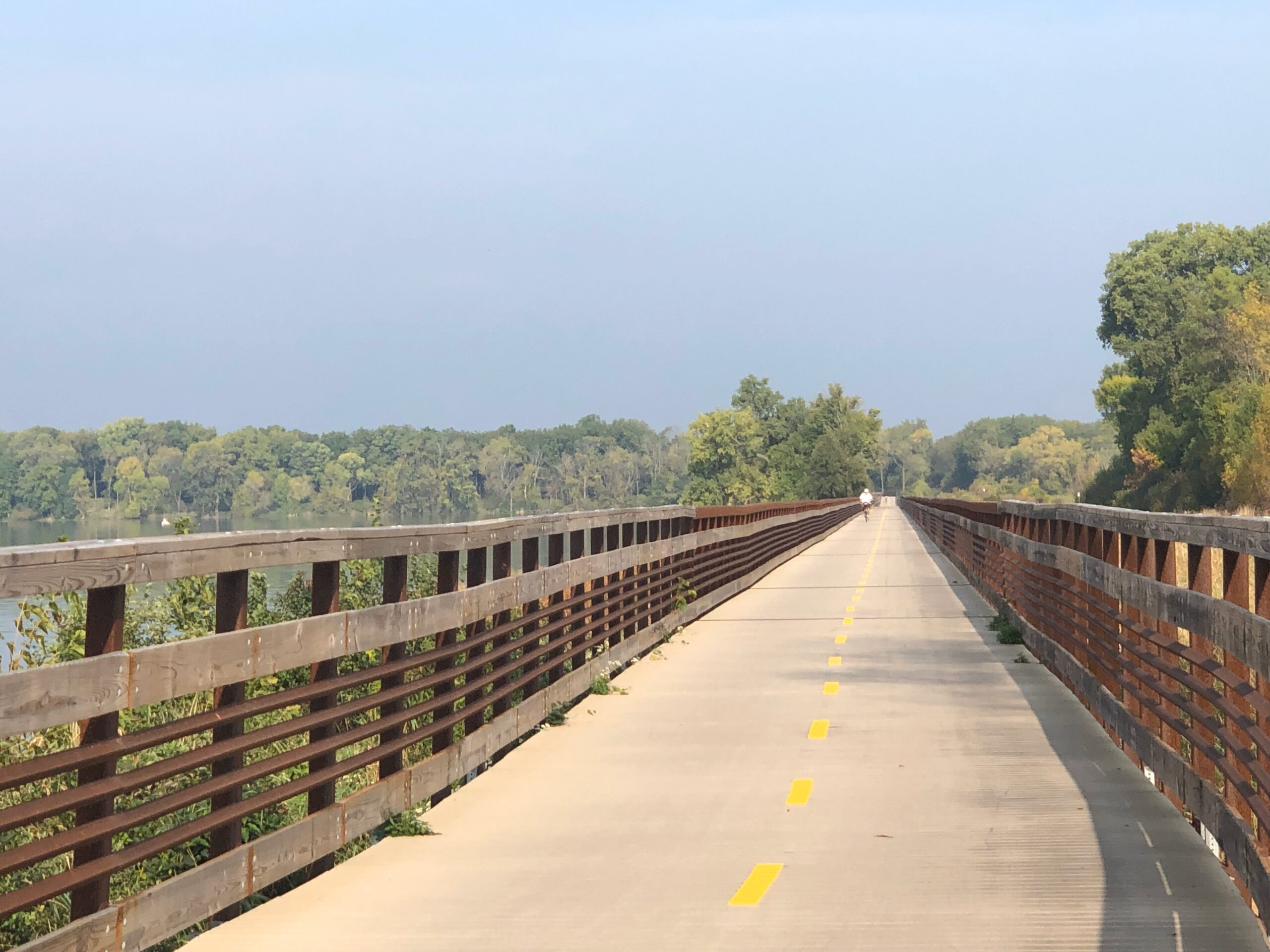
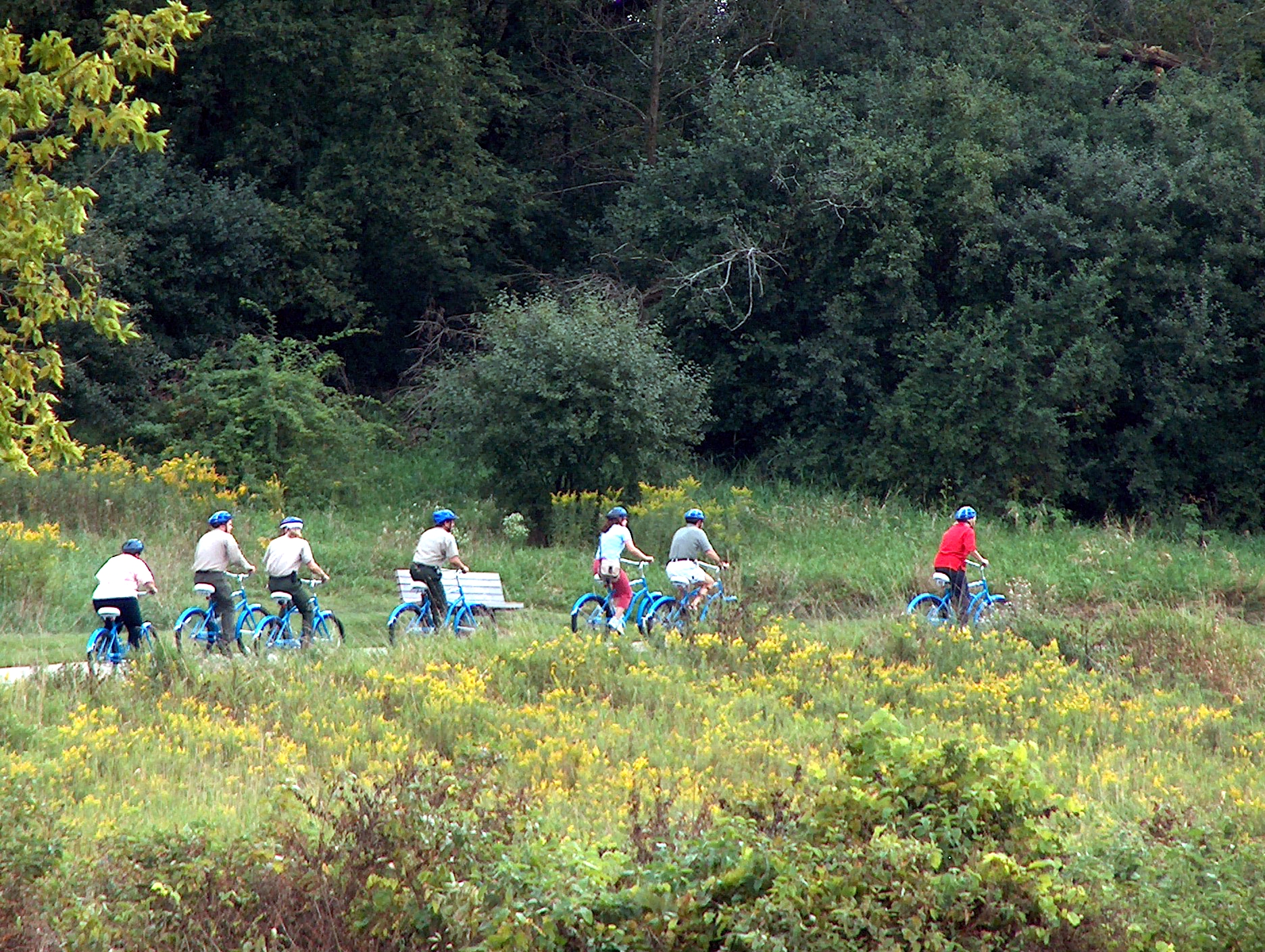
Description: 2.5 miles of paved trail with a .9 mile long boardwalk bridge, the longest of its kind in North America. The trail goes through prairie, marsh and across Lake Waubesa! The trail presently ends at McDaniel Park in McFarland, but will be expanded in the future. Here’s your connection from McFarland to the Capital City Trail, which leads to the hub of Madison area bike trails.
Enjoy hiking, jogging, bicycling, rollerblading and roller skiing on a paved surface. Note: no dogs are allowed on the bridge. No trail pass required at this time.
About the Capital City State Trail
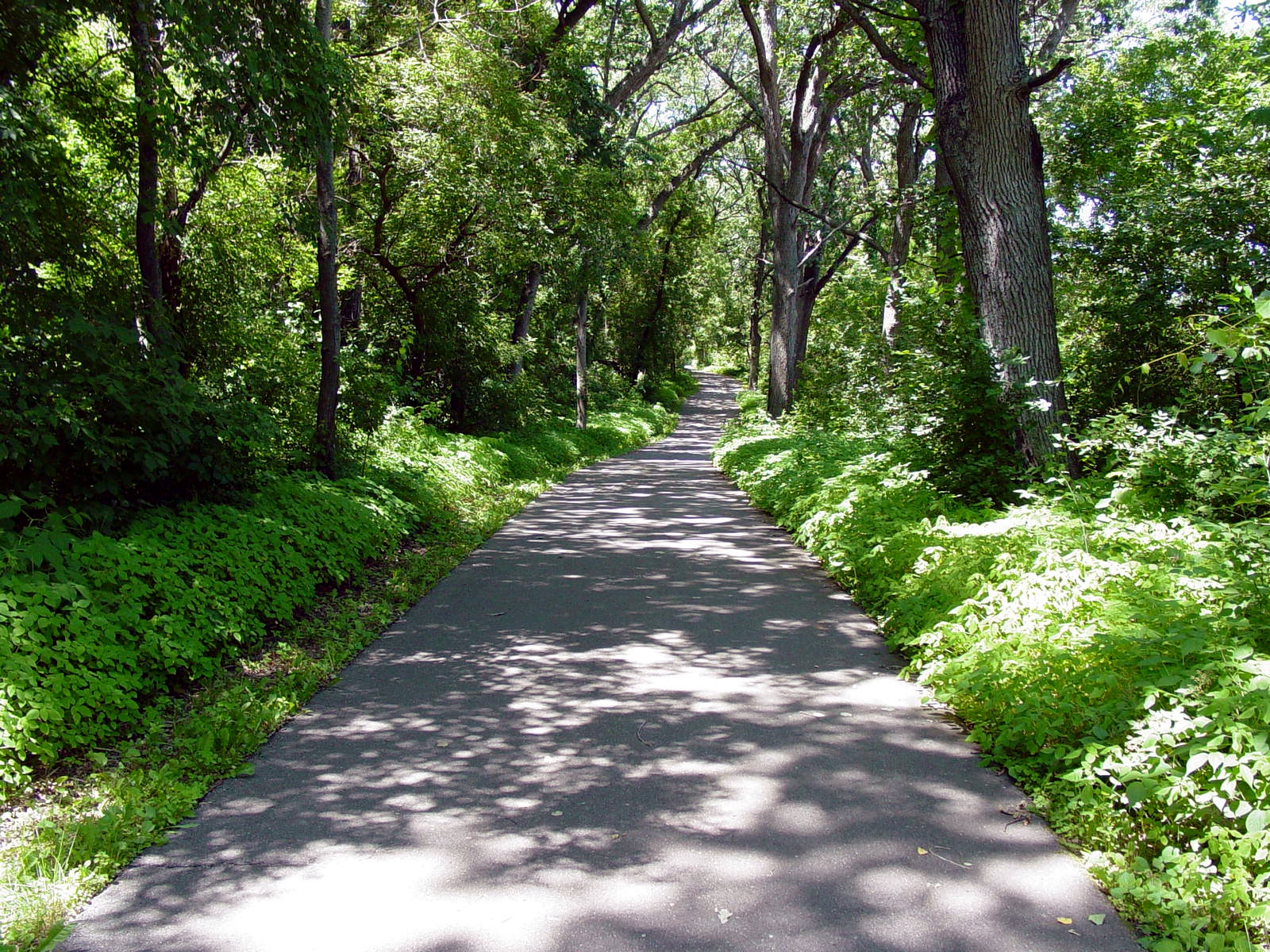
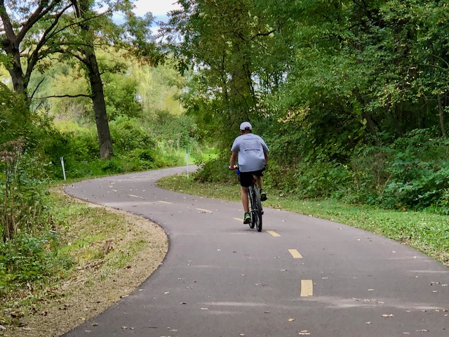
Description: 9.5 miles of paved trail with some hills. Enjoy hiking, jogging, bicycling, rollerblading and roller skiing on a paved surface. The Capital City State Trail serves as the hub of the Madison biking system linking Military Ridge State Trail, Badger State Trail, City of Madison and City of Fitchburg trail corridors. Motorized vehicles, horses and hunting are prohibited on the trail.
Natural Features of the CCT
The Capital City Trail passes through the Lewis E-way unit of Capital Springs Recreation Area. Visitors enjoy shady woodlands, prairies and wetlands in the diversity of landscapes. These habitats offer excellent wildlife viewing and natural beauty along the way.
Lake Farm Park, anchored on the east end of the trail, provides restrooms, water and camping opportunities. The trail also passes through other units of Capital Springs Recreation Area, including the Jenni and Kyle Preserve and the Nevin Springs Fish Hatchery and Hunting Grounds before entering into urban green way.
Other CSRA Trails
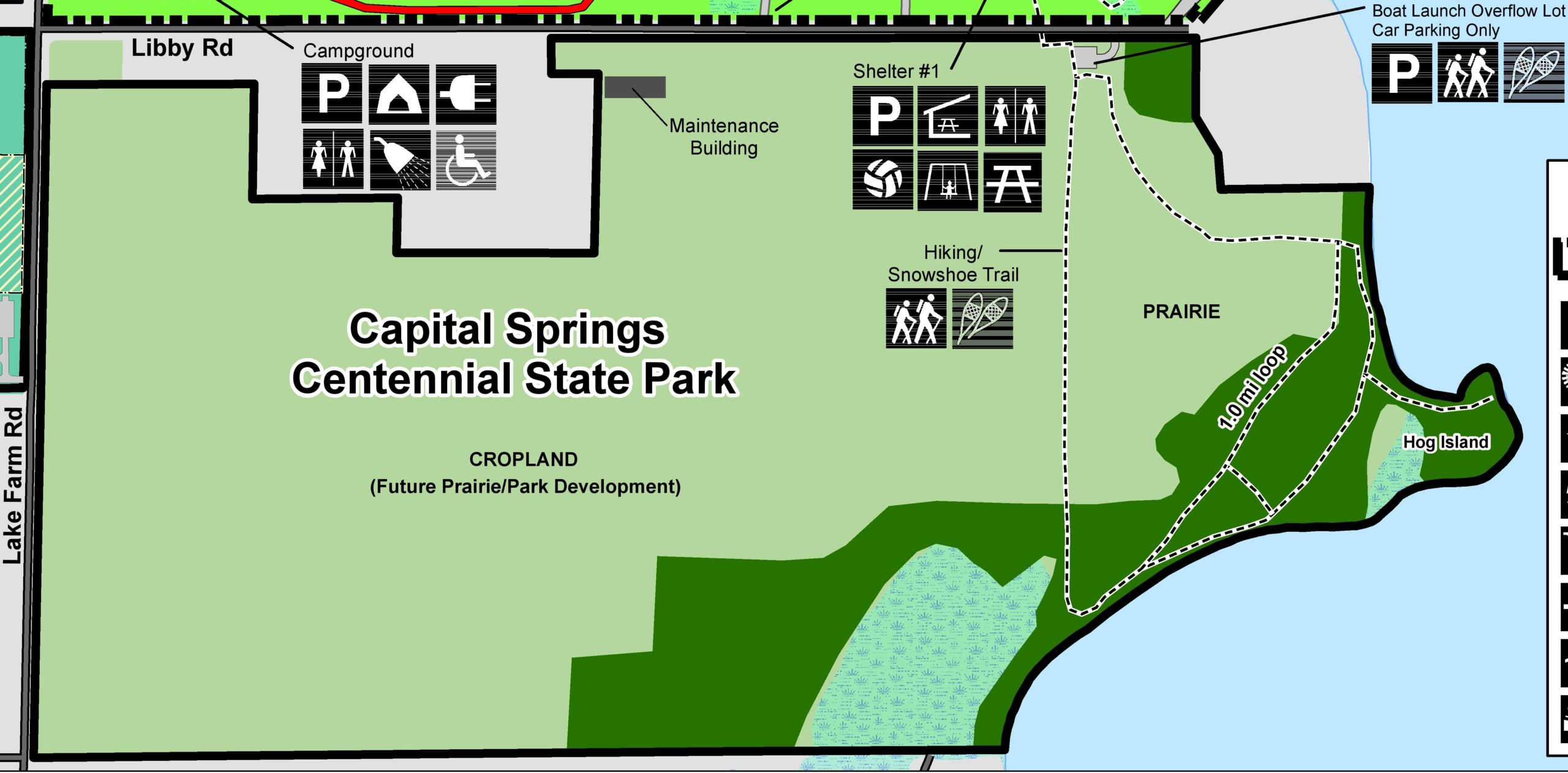
LUNNEY LAKE FARM HERITAGE TRAIL: Easy, 2.1 miles
Take a self-guided interpretive hike around the shores of Lake Waubesa at Lunney Lake Farm County Park on Libby Road. Interpretive signage along this trail explains the cultural and historical significance of the area and how early people relied on the rich natural resources of marsh, lake and upland habitats. The observation tower is located near shelter #1 and is open seasonally.
WHITETAIL TRAIL: Easy, 1.3 miles
Linking the shelters and group camp, this trail offers wonderful views of wetlands and wildlife. The trail overlaps with the Lake Farm Heritage Trail to offer views of beautiful Lake Waubesa. The observation tower is located near shelter #1 and open seasonally.
LEWIS E-WAY TRAIL: Easy, 2.7 miles
The gateway to the Lewis Nine Springs E-Way Corridor starts here. This tranquil wetlands trail meanders alongside the Nine Springs Creek through the heart of the E-Way before connecting to the Capital City State Trail. It also connect with the Baxter Park Trail.
BAXTER PARK SPUR TRAIL: Easy
A connector trail from the Capital City State Trail to the City of Madison-Baxter Park.
LUSSIER-DRUMLIN TRAIL: Moderate, 1.6 miles
Enjoy sloping trails through restored prairie and marsh. The trail begins behind the Lussier Family Heritage Center; from here, the trail splits into two hikes: a loop trail back to the Lussier Center or an additional half-mile hike across Lake Farm Road, including a climb on top of a drumlin, with long vistas of Capital Springs in both directions.
- The loop trail meanders through prairie and overlooks MMSD lagoons and large areas of marsh toward Lake Waubesa. It also maintains an Educational Trail Guide with eight post stops covering the history and value of Capital Springs marsh and prairie – pick up a copy of the Guide in the Lussier Center.
- For a longer route, hike across Lake Farm Road to the half-mile glacial moraine and enjoy outstanding views of marsh, the E-Way, MMSD lagoons, and Lake Waubesa. The E-Way trail rests in the middle of beautifully restored upland prairie and maintains an observation deck on the western portion of the trail.
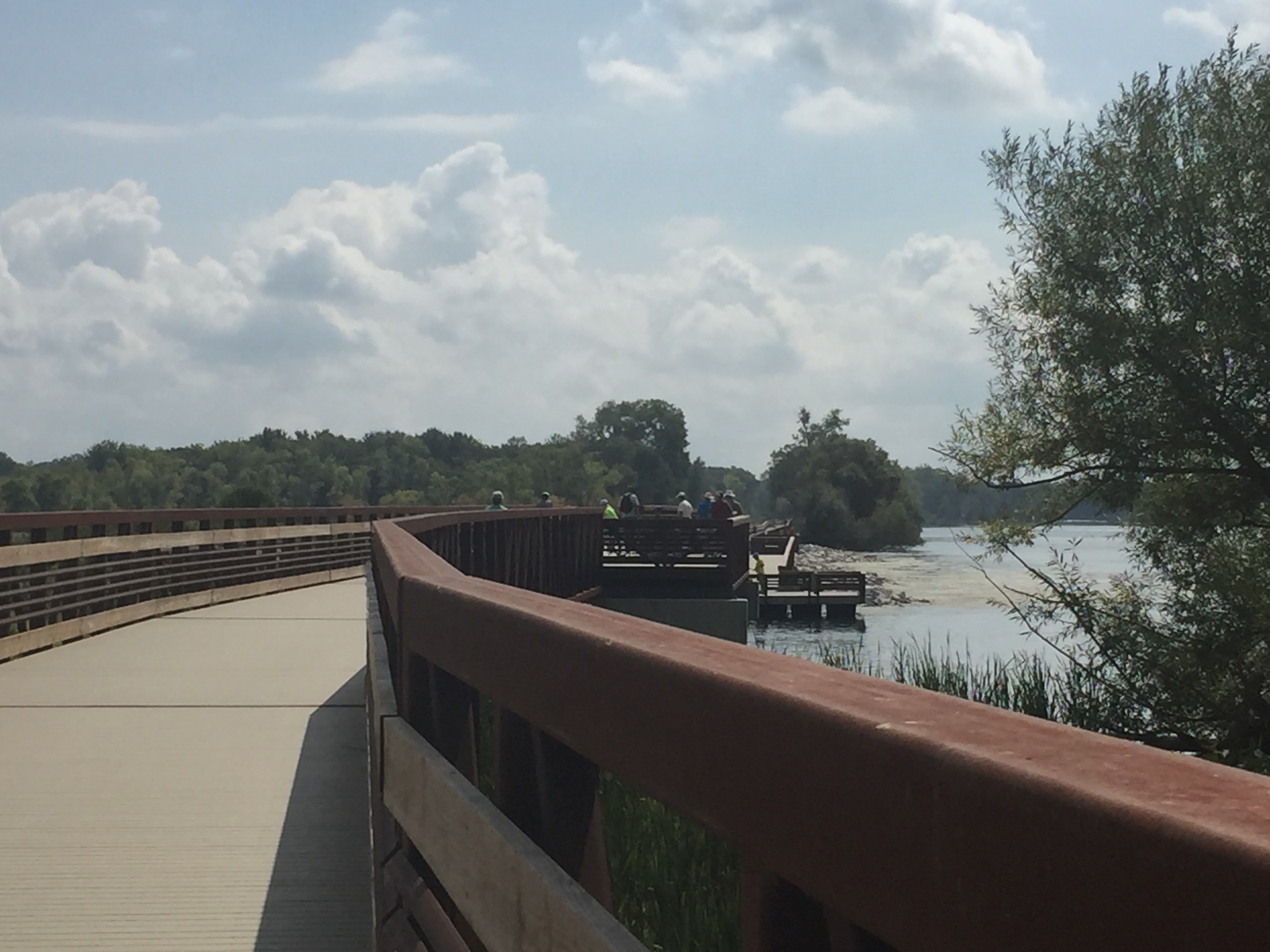
MADISON METROPOLITAN SEWERAGE DISTRICT’S WILDLIFE OBSERVATION AREA TRAILS: Easy, 3.3 miles
Trails winding through the District’s Wildlife Observation Area reconstructed wildlife habitat are a bird watcher’s delight. The trail also offers an elevated boardwalk and observation platform.
CROSS-COUNTRY SKI TRAILS:
Enjoy groomed trails throughout Capital Springs, including the E-Way and Lake Farm County Park. See the map for more details. Ski passes are required and available online for purchase from Dane County.
⇒ Ski Trail Maps